By Melissa Wynn
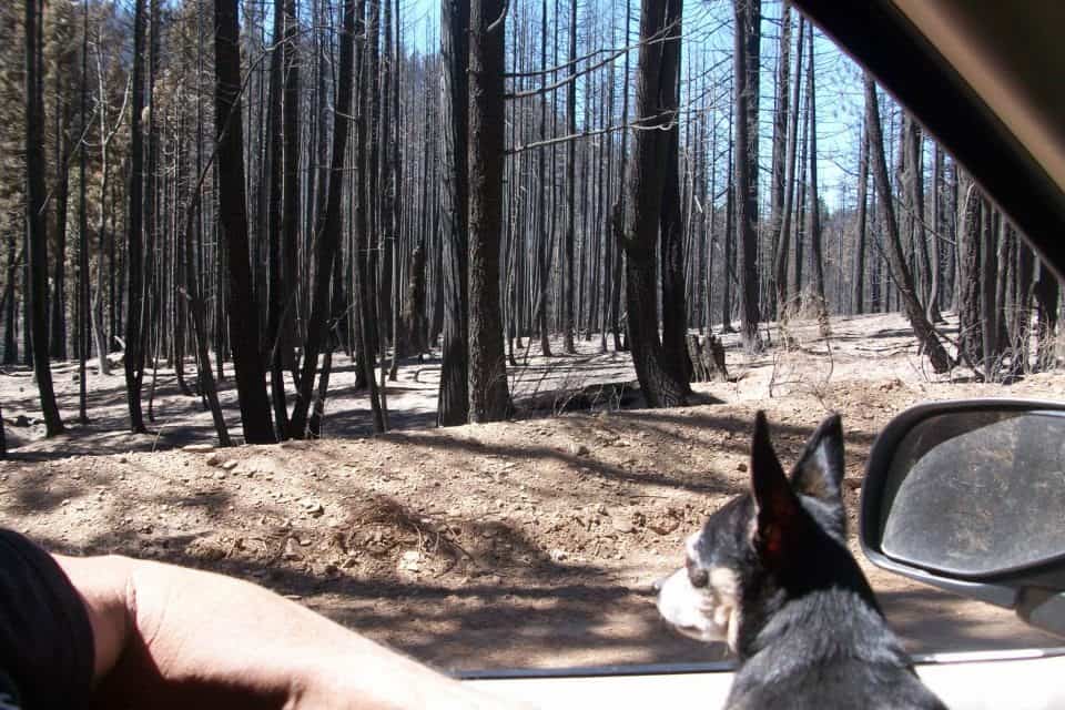
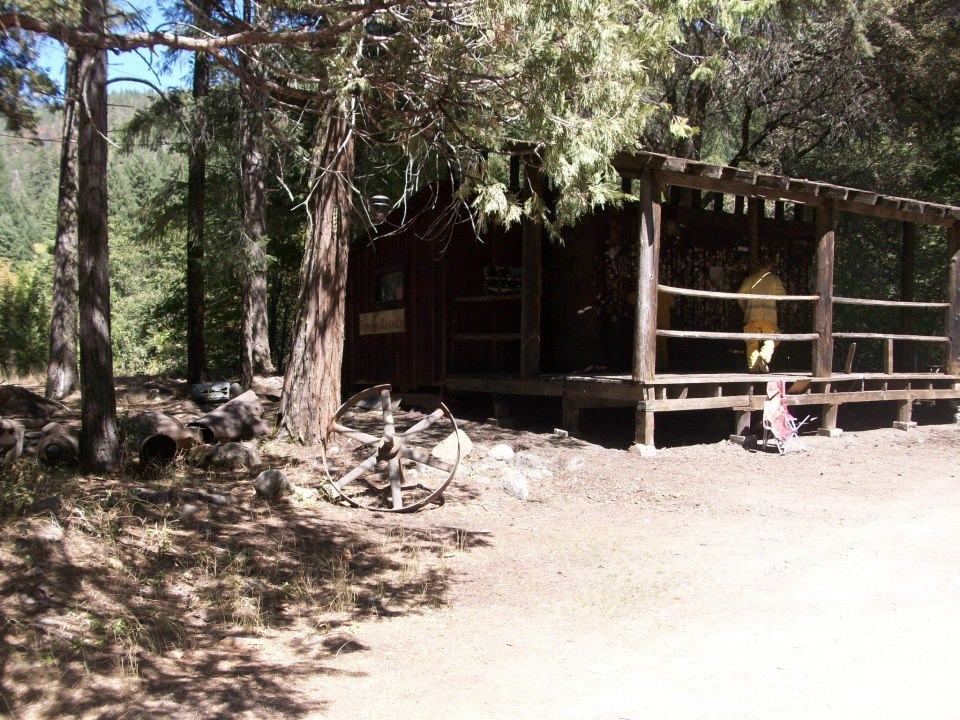
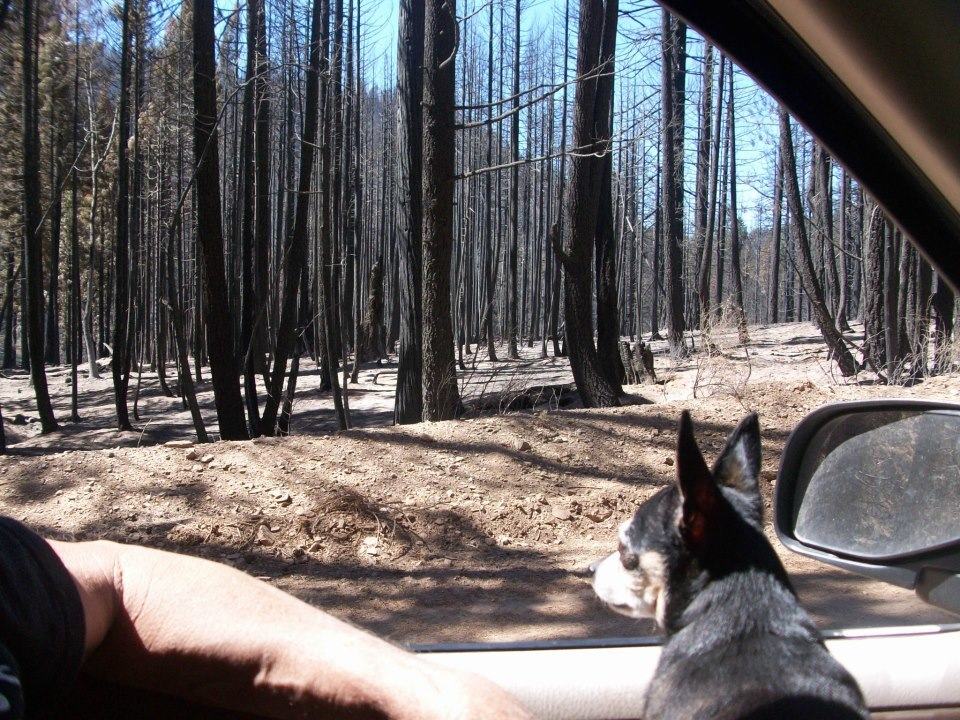
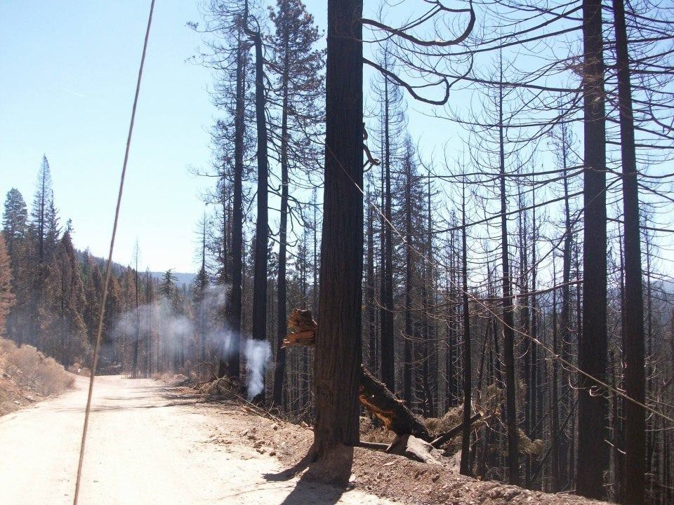
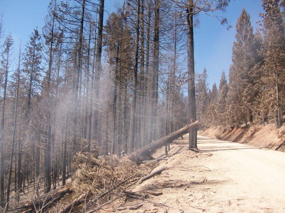
On Sunday July 1st, just before 2:00 a.m., the forest fire named “Chips” started burning 20 miles north west of Quincy in the heart of our own beloved Plumas County. To read about it on the web, or see the few minutes of footage on the news, it would seem that utter devastation now covers over 75,000 acres of our mountain home. However, if there was one thing I learned through that frightening experience it was that forest fire behavior is not at all what I thought it was. When you view the Chips Fire Map on the internet, the red shaded areas would lead you to believe that there is nothing but charred remains from Hwy 70 near Belden, through the valleys to Butt Lake and on up to Lake Almanor’s North Shore. Nothing could be further from truth. Make no mistake, as I drove through the burn, shortly after 100% containment was achieved, I did see areas like we all imagined. Large patches in the forest of eerie looking blackened tree trunks atop a forest floor of ash where beautiful towering pines once stood broke my heart. However, those areas are sporadic throughout the burn area and vary greatly in size. The drive down the Seneca Road, just off Hwy 89 at Canyon Dam, afforded me a birds eye view of several of the canyons effected by the burn. I celebrated when I saw how much of the forest had remained just as it was before the fire. The area marked on the map simply encloses the area of Chips ultimate containment. It by no means encloses a purely burned up area. Some areas are merely scorched and will recover. Some trees stand dead with withered pine needles, but not blackened. One corner in the road would look as if nothing ever happened and the next looked like I had always pictured a forest fire to leave the woods. As I stood on the bluffs at the top of Seneca Road, I could easily spot areas of each of these levels of intensity that the Chips Fire threw our way. It almost looks like several little fires happened, versus one big one named Chips. This is a drive worth taking for anyone that would like to see the aftermath of a forest fire with their own eyes. Butt Lake Road off of Hwy 89 on Lake Almanor’s East Shore is another convenient route to take into the burn. There are also several back roads off of Hwy 70 near Belden that meander back into the Chips burn area as well. As you drive the 52 miles of shore line around our crystalline Lake Almanor, you would never know that just months ago we were on the news and facing evacuation from forest fire threat. Our shores are still skirted by pristine views of Plumas National Forest. When you drive to the bottom of the Seneca Road, the famous and historic Gin Mill in the ghost town community of Seneca still stands. For decades, folks from around the globe have pinned business cards on the walls, ceiling and exterior of this building nearly a century old. Although many of the cards on the outside were ruined by fire retardant, sprayed by the brave men and women that fought this awful fire to save the site for posterity, the ancient tavern itself still remains. Those of us that have wandered this natural playground throughout our lives will be forever grateful to those that risk their lives to save our homes and forests from wild land fire. Don’t be afraid to come visit us up here in the hills because we had a fire. Come see for yourself the mysterious aftermath of a forest fire.


