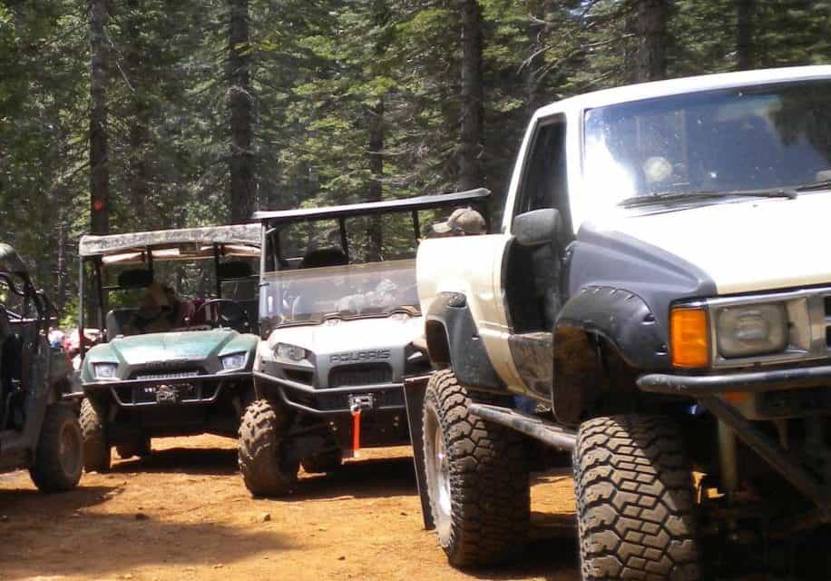
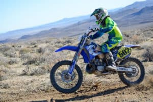
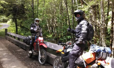
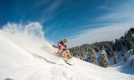
California welcomes dirt bikers, snowmobilers, dune buggies, ATVs and 4 wheel drives in selected areas across the state. So, gather your gear! You’ll find 130+ terrain parks in California at OHV.parks.ca.gov. We chose a few NorCal favorites to share with you.
Plumas National Forest Backcountry Discovery Trail. Pick up a Motor Vehicle Use Map (MVUM); it explains all travel regulations and is available free of charge at any Forest Service office, or download it at www.fs.usda.gov/Internet/FSE_DOCUMENTS/stelprdb5428383.pdf .
 Complete driving instructions are included, pointing out historic sites along the way. The entire route encompasses 150 miles and traveling the entire distance could take a few days. Estimated driving times do not include stopping at the Discovery Points. There are 30 of them featuring scenic overlooks, historic ghost towns, mines, geologic formations and more. Trails are marked with Backcountry Discovery Trail signs. The non-paved roads are maintained for use by SUVs and high-clearance vehicles. Other travelers include ATVs, motorcycles and horses.
This trail begins in the town of La Porte and ends at the intersection of County Road 305 with State Highway 89, by Lake Almanor. There are seven sections of the trail; some are more challenging than others so it is good to read the guide for description of terrain. The map in the guide shows where motorized vehicle use is allowed. Some areas, marked as alternate routes, are best traveled in a 4-wheel drive vehicle, ATV or dirt bike. Off-road vehicles must stay on designate routes.
You can call any Plumas National Forest Service office for the latest road conditions and other current updates, such as road work or wild land fires, that may affect travel.
Plumas Backcountry Discovery Trail:
Your Planning Checklist
•Plumas National Forest Visitor Map (available at any Forest Service office.) A Plumas National Forest Atlas is also available at any Forest Service office or online at www.nationalforeststore.com
•MVUM containing travel regulations at www.fs.usda.gov/ main/plumas/maps-pubs
•Adequate food, water and fuel
•Friends to share the fun and assist in an emergency
•GPS unit, binoculars and camera
•Campfire permit. If you plan to use a fire, barbecue or camp stove, pick up a free campfire permit at any Forest Service office. Be sure to check for restrictions.
• Before you leave, inform others where you are going. Leave a copy of a detailed itinerary.
• For more safety information, go to www.cal4wheel.com
MORE LOCAL RIDING SPOTS:
• Redding Field Office +1530.224.2100: CHAPPIE-SHASTA OHV AREA –dirt bikes, 4WDs, ATVs and dune buggies. 10 miles northwest of Redding, 200 miles of roads and trails span approximately 52,000 acres. Elevation ranges from 600 to 5,000 feet with a wide variety of terrain. The southeast portions offer rocky and challenging terrains. The northwest portions offer views of Mt. Shasta, Lake Shasta and the Trinity Alps.
• Eagle Lake Field Office +1.530.257.0456:
•FORT SAGE OHV AREA – Managed by the US Bureau of Land Management – ATVs, dirt bikes, 4WDs, and dune buggies. About 45 miles north of Reno you will find approximately 22,000 acres in this high desert region. Terrain includes flat, sandy, high desert sagebrush country and rocky, steep canyons and gulches.
• Mt. Hough Ranger District +1.530.283.5555: DEADMAN SPRINGS / SNAKE LAKE – Dirt Bikes, 4 WDs, ATVs and snowmobiles
Located near Quincy and Greenville
• Feather River Ranger District – +1.530.534.6500: Cleghorn Bar / Poker Flat – Dirt bikes, 4WDs, ATVs and snowmobiles
• Beckworth Ranger District +1.530.836.2575:
• Gold Lake – dirt bikes 4WDs, ATVs and snowmobiles
• Army Corp of Engineers +1.530.865.4781:
•Black Butte Lake – Orland Area – dirt bikes and ATVs
•Clay Pit State Vehicular Recreation Area – Clay Pit Ranger Station: +1.530. 538.2212
•CLAY PIT SVRA-Clay Pit is two miles west of the town of Oroville, where a 220+ acre SVRA provides a fenced open riding area for motorcycle, ATV, and 4×4 enthusiasts.


